Esztergom
 |
 |
Esztergom is the seat of the prímás (see Primate) of the Roman Catholic Church in Hungary, and the former seat of the Constitutional Court of Hungary. The city has a Christian Museum with the largest ecclesiastical collection in Hungary. Its cathedral, Esztergom Basilica, is the largest church in Hungary.
The Roman town was called Solva. The medieval Latin name was Strigonium. The first early medieval mention is "ſtrigonensis [strigonensis] comes" (1079-1080).
The first interpretation of the name was suggested by Antonio Bonfini. He tried to explain it from Istrogranum, "city at the confluence of Ister (the Greek name of the Danube river) and Gran (the Latin name of the river Hron)". This interpretation is still popular. Viktor Récsey attempted to derive the name from Germanic languages. After the conquest of the country by Charlemagne, the Franks should give the name Osterringun to their easternmost castle; as a comparison, a reference is made to the town of Östringen. Pavel Jozef Šafárik tried to explain the name from Slavic ostřehu (locus custodius, munitus). Gyula Pauler suggested a Slavic personal name Stigran without a deeper analysis of its origin.
In 1927, Konrad Schünemann summarized these older views and proposed the origin in a Slavic stem strěg ("custodia", guard). This theory was later extended by Ján Stanislav who also explained the origin of the initial vowel missing in Latin and later Czech sources (Střehom). The introduction of a vowel before the initial consonant group is a regular change in the Hungarian language (Stephan → István, strecha → esztercha), but the initial "O" in later Slavic forms can be explained by an independent change–an incorrect decomposition of the Slavic prepositional form. Both authors noticed the high number of Slavic placenames in the region (Vyšegrad, Pleš, Kokot, Drug, Komárno, Toplica, etc.) and similar Slavic names in other countries (Strzegom, Střehom, Stregowa, etc.). Both authors believed that the stem strěg was a part of the Slavic personal name, but Šimon Ondruš suggests a straightforward etymology. The Proto-Slavic stregti – to watch, to guard, present participle stregom, strägom – a guard post. The later Slavic form was created by an incorrect decomposition as follows: vъ Strägome (in Strägom) → vo Strägome → v Osträgome like Slovak Bdokovce → Obdokovce, Psolovce → Obsolovce.
Lajos Kiss considered the name to be of uncertain origin, potentially derived also from Slavic strgun (a tanner) or Proto-Bulgaric, - a leather armor However, the last theory is sharply criticized by Šimon Ondruš as obsolete and unreliable, because of its dependency on later sources, the high number of Slavic names in the region and missing adoption of the word in the Hungarian language.
Other names of the town are Croatian Ostrogon, Polish Ostrzyhom, Serbian Ostrogon and Estergon (also Turkish), Slovak Ostrihom and Czech Ostřihom (the archaic name is Střehom). The German name is Gran, like the German name of river Garam. Istergom, Esztergom. Ister, the old name of Danube. Gom/hun/ is arch like, gomb/hun/ is (coat button), gömb/hun/ is (sphere).
Map - Esztergom
Map
Country - Hungary
 |
 |
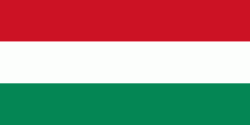
| Flag of Hungary | |
The territory of present-day Hungary has for centuries been a crossroads for various peoples, including Celts, Romans, Germanic tribes, Huns, West Slavs and the Avars. The foundation of the Hungarian state was established in the late 9th century AD with the conquest of the Carpathian Basin by Hungarian grand prince Árpád. His great-grandson Stephen I ascended the throne in 1000, converting his realm to a Christian kingdom. By the 12th century, Hungary became a regional power, reaching its cultural and political height in the 15th century. Following the Battle of Mohács in 1526, it was partially occupied by the Ottoman Empire (1541–1699). Hungary came under Habsburg rule at the turn of the 18th century, later joining with the Austrian Empire to form Austria-Hungary, a major power into the early 20th century.
Currency / Language
| ISO | Currency | Symbol | Significant figures |
|---|---|---|---|
| HUF | Hungarian forint | Ft | 2 |
| ISO | Language |
|---|---|
| HU | Hungarian language |


